

The City of Columbia has released the official detour map for the Mt. Olivet Bridge closure, which took effect Monday, July 13, due to structural concerns identified during a recent inspection.
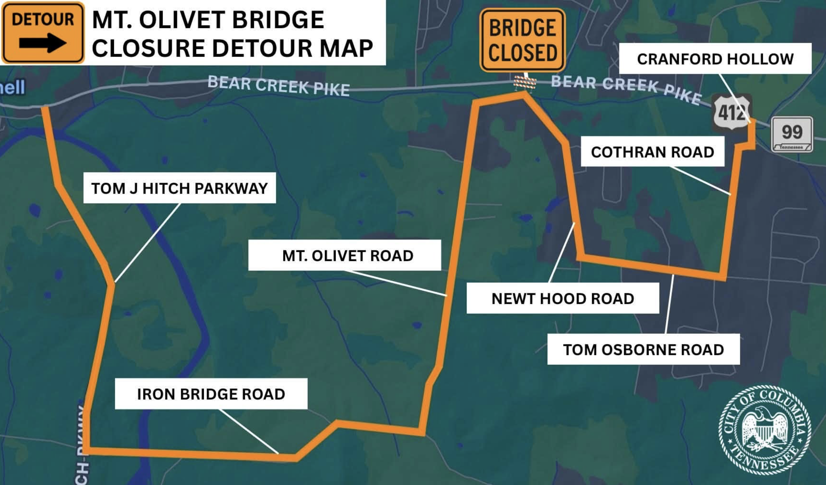
Drivers headed toward the closed span on Bear Creek Pike will be routed off onto Newt Hood Road, over to Tom Osborne Road and Cothran Road, and back out to Bear Creek Pike near Cranford Hollow and Highway 99. On the other side of the closure, the detour runs along Tom J. Hitch Parkway, Mt. Olivet Road, and Iron Bridge Road to complete the loop around the closed bridge.
The city says the Mt. Olivet Bridge replacement is a Tennessee Department of Transportation project funded by the state, and it remains on the books for 2029. Columbia has formally asked TDOT to look at moving that timeline up given the impact the closure is having on local travel, though no revised schedule has been confirmed.
The city says it will continue coordinating with TDOT and will share updates on the project timeline and construction schedule as they become available. In the meantime, drivers are encouraged to follow the posted detour signage and build extra time into trips that cross Bear Creek in that area.
Sources: City of Columbia official announcement, July 2026.